
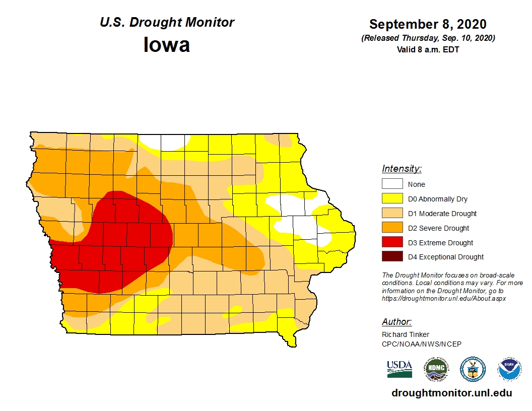
There was slight improvement on the latest U.S. Drought Monitor Report, and more significant improvement is expected in next week’s numbers.
All of Marion and almost all of Warren County remains in a moderate drought, with improvement to extreme southwestern Warren County to abnormally dry. The rest of the region remains in moderate to severe drought, especially along Interstate 80. Most of the rain that fell this week did so after the 8 a.m. cut off Tuesday, and will be included in next week’s numbers.
According to the National Weather Service, widespread amounts of 1 ½ to 3 inches of precipitation have fallen over most of the state of Iowa this week. Additional chances for showers remain in the forecast today, which will likely impact many local high school football games. An additional 1-2 inches of rain is possible by Saturday morning, especially east of Interstate 35 in south central Iowa.
For the third day in a row, the coldest high on record was broken, as the daytime temperature only reached 55 degrees, breaking the previous mark of 59 set in 2007. More seasonable air returns this weekend, with highs in the upper 70s, and dry and comfortable conditions setting in next week.
Local rainfall totals (from Monday evening Thursday at 3 p.m.):
Pella – 2.03”
Lake Red Rock – 2.27”
Knoxville – 2.07”
Indianola – 1.9”
South River near Ackworth – 2.05”
White Breast Creek near Melcher-Dallas – 2.45”
Des Moines River near Swan – 2.16”
Cedar Creek near Bussey – 1.45”
Des Moines River near Tracy – 1”