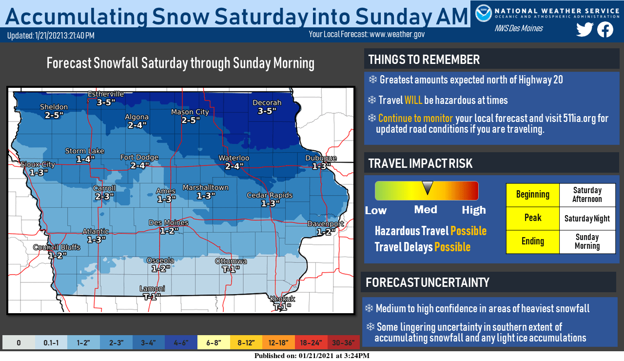
After the warm middle of the week and quiet, but colder, end to the work week, the weekend will generally be filled with snowfall opportunities. The first of which will begin to slide into the state from the west/northwest Saturday afternoon and through the overnight hours. As a result, the greatest snowfall amounts are expected to fall along and north of Highway 20 where around 2″ to 5″ is currently forecast. Amounts taper off to around an inch or two along Interstate 80.

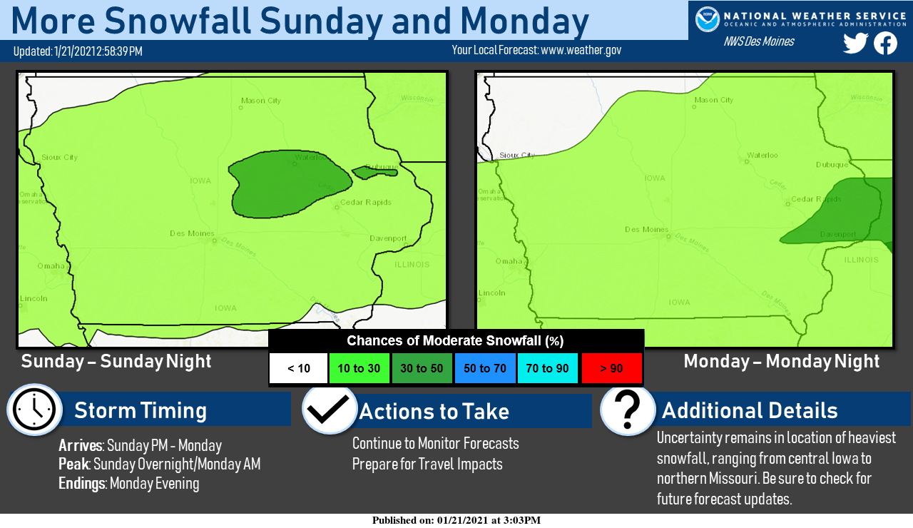
After snowfall winds down Sunday morning, additional chances for snow will slide through the state during the day Sunday and again on Monday. For the time being, there remains question as to where the heaviest snowfall will reside, ranging from central Iowa to northern Missouri. If you are planning on traveling around the state Sunday or Monday, please use caution, stay tuned to forecast updates, and be sure to check out 511ia.org for current road conditions.

