
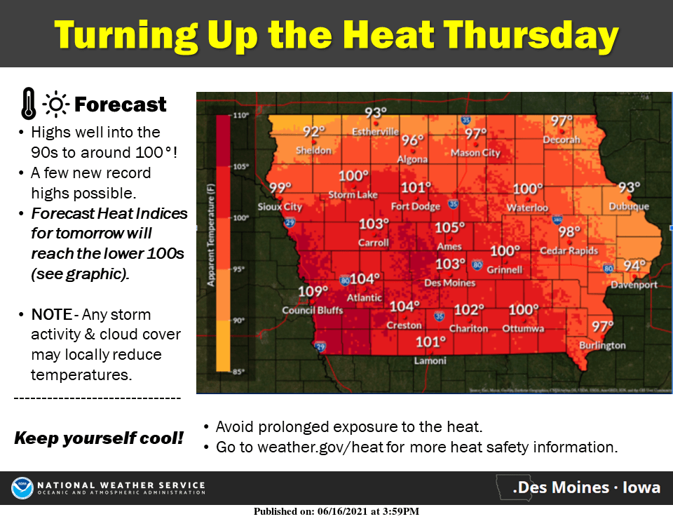
Record heat is in the forecast today, as well as a slight chance for much needed rain in the form of thunderstorms.
According to the National Weather Service, daytime highs will approach the upper 90s and potentially top 100 degrees. A heat advisory is in effect from 1 to 8 p.m. Those planning to be outdoors should take frequent breaks in shade or air conditioning and stay hydrated.
The previous record high temperature for June 17th in Marion County is 97 degrees set in 1940. However–despite the high heat, relative humidity is expected to remain low, so heat index values should feel close to the actual air temperature.
The first significant chance for rainfall in three weeks will continue through the overnight. However, storms will be scattered in nature, and any that pop up across the region may be severe, as the National Weather Service Storm Prediction Center has issued a marginal risk for hail and damaging winds.
Stay tuned to KNIA/KRLS for the latest weather information.