
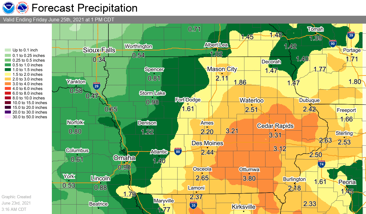
An active week for thunderstorms continues Thursday and Friday across south central Iowa. According to the National Weather Service, several rounds of precipitation remain possible through the end of the work week. Widespread additional amounts of 1-2” of rain in the forecast, and higher amounts likely with thunderstorm activity. A slight risk of severe weather is in place again Thursday as well, as many of the storms are capable of producing large hail and damaging winds. Most of south central Iowa entered this week in moderate drought conditions, with more severe drought reported in portions of Polk, Jasper, and Warren Counties.