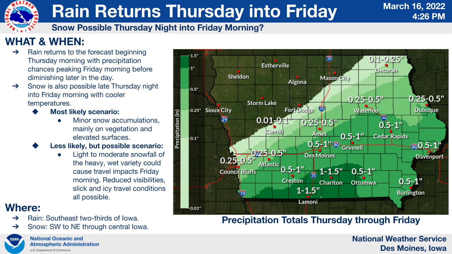
Rounds of precipitation are expected today across south central Iowa, and could linger into Friday. During the warmer daytime hours, precipitation will be rain, then overnight will range from a cold rain to potentially heavy wet snow. Areas that see the heaviest snowfall rates may see accumulations on roadways that would make travel tricky, but the most likely is that frozen accumulations would be largely limited to grassy and elevated areas. As precipitation slowly moves out Friday, it will return to all rain, according to the National Weather Service. Colder air in the 40s will bounce back into the 50s and 60s by the weekend.

