
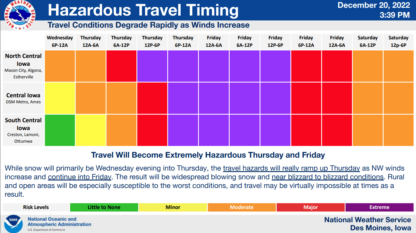
The National Weather Service has issued a Winter Storm Warning starting Wednesday at 6 p.m locally, which continues through Saturday morning.
This is a significant multi-faceted event, including the potential for blizzard conditions and extreme cold. Travel could be dangerous to near impossible at times Thursday and Friday. Extreme cold is expected as well with wind chills falling to 20 to 40 below zero or colder from late Thursday through the end of the week.
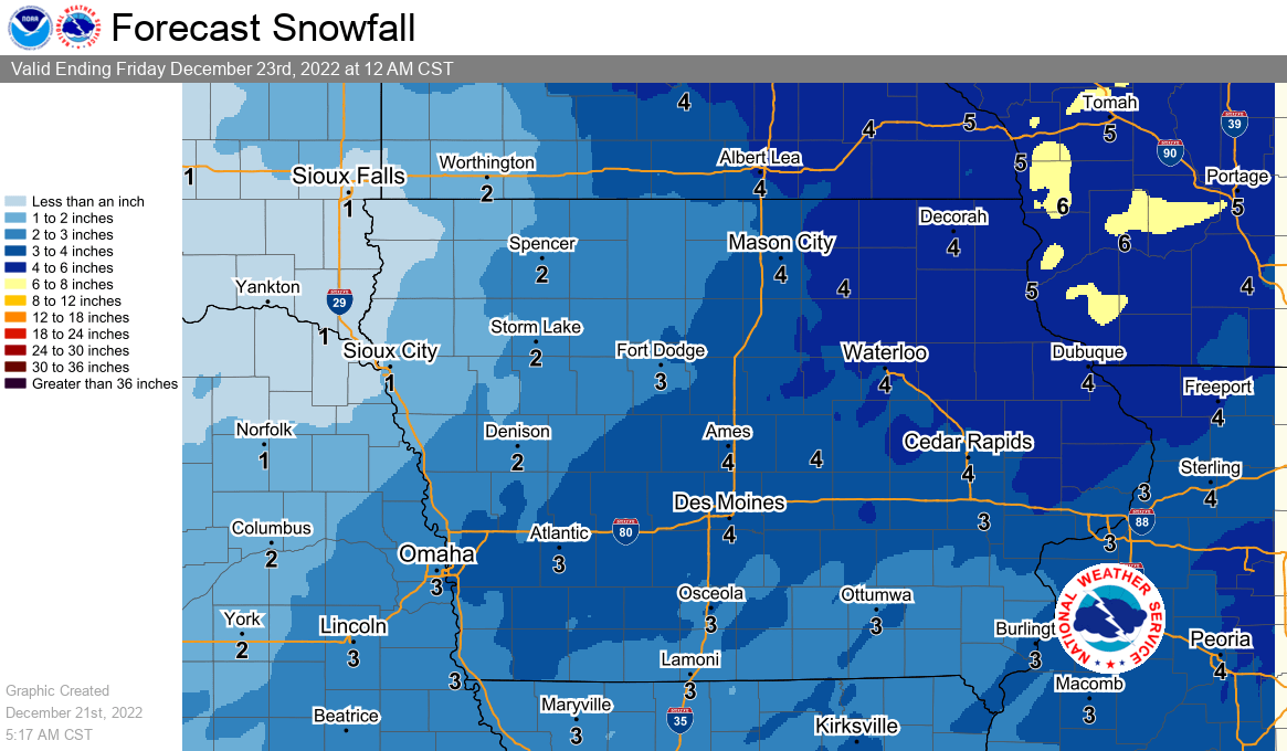
Snow and blowing snow will begin around noon on Wednesday and continue into Friday night. Blizzard conditions remain possible Thursday morning into Friday. Total snow accumulations of 3 to 5 inches are widely expected, with locally higher amounts possible. Wind gusts of 40 to 50 mph or greater may occur late Thursday through Friday.
Those with holiday travel planned from late Wednesday through Friday are strongly encouraged to pay close attention to forecast updates and road conditions, and prepare accordingly if travel is a must. Altering travel plans, if possible, is strongly encouraged.
National Weather Service Meteorologist Allan Curtis joined KNIA/KRLS Pella News Director Andrew Schneider to discuss the hazards of this week’s winter storm. A winter storm warning is in effect from 6 p.m. Wednesday until 6 a.m. Saturday.