
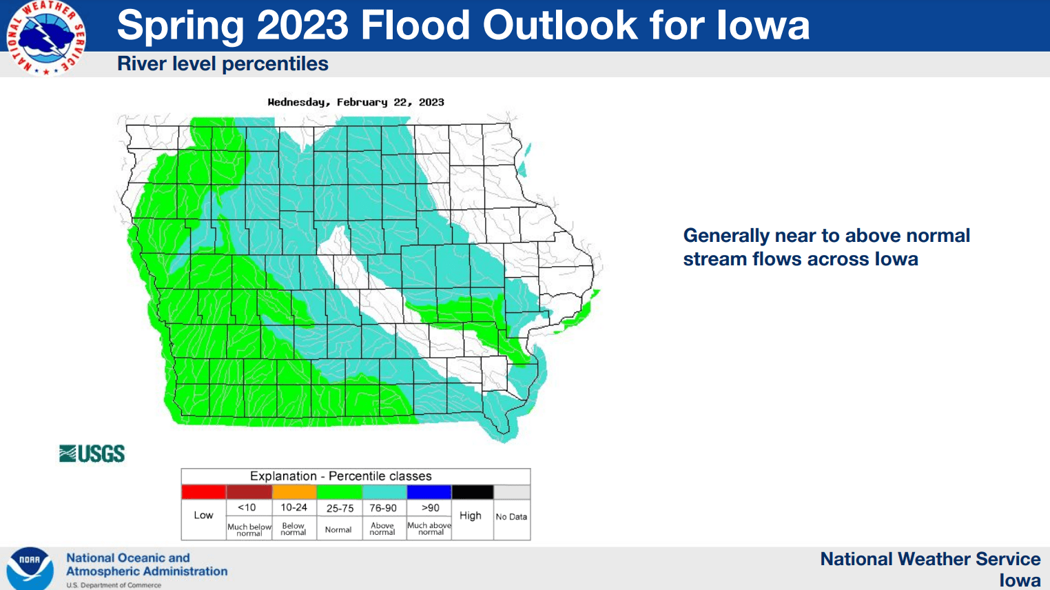
It’s been two weeks since the first of three Spring Flood Outlooks from the National Weather Service was issued, and the second update on Thursday shows a slightly increased risk for river flooding across the state and in south central Iowa.
Major winter storms and rounds of light-to-moderate rainfall have helped relieve drought conditions and increased stream flows in many locations. Senior Hydrologist Jeff Zogg says their latest report indicates that the overall risk is not higher than normal, due to those factors and others.
Flooding related to ice jams remains very low, as warmer-than-average conditions in February have prevented rapid melting and has kept most streams ice free, especially in the southern half of the state.
The National Weather Service Climate Prediction Center shows higher-than-normal precipitation is expected through mid-March. In the short-term, heavy rainfall remains a possibility late Sunday through early Monday, with most of south central Iowa expected to receive close to an inch of precipitation.