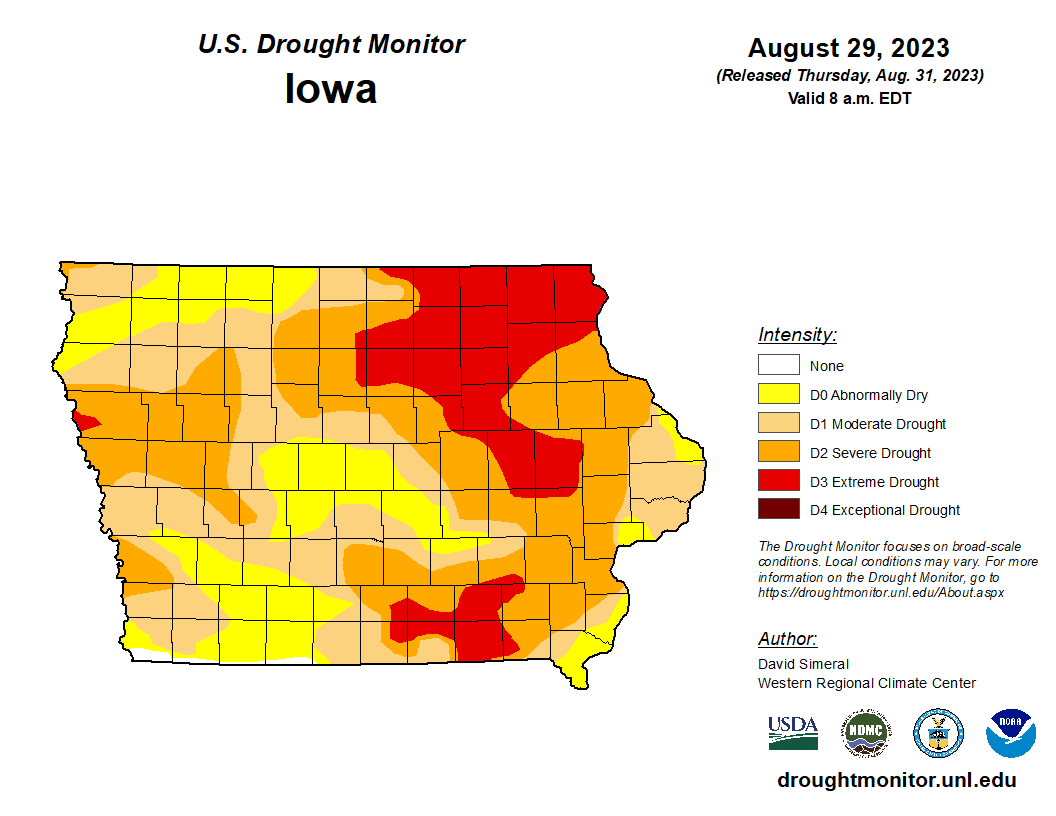
Several recent stretches of hot weather, coupled with a lack of significant rainfall, has drought worsening across south central Iowa and most of the state.
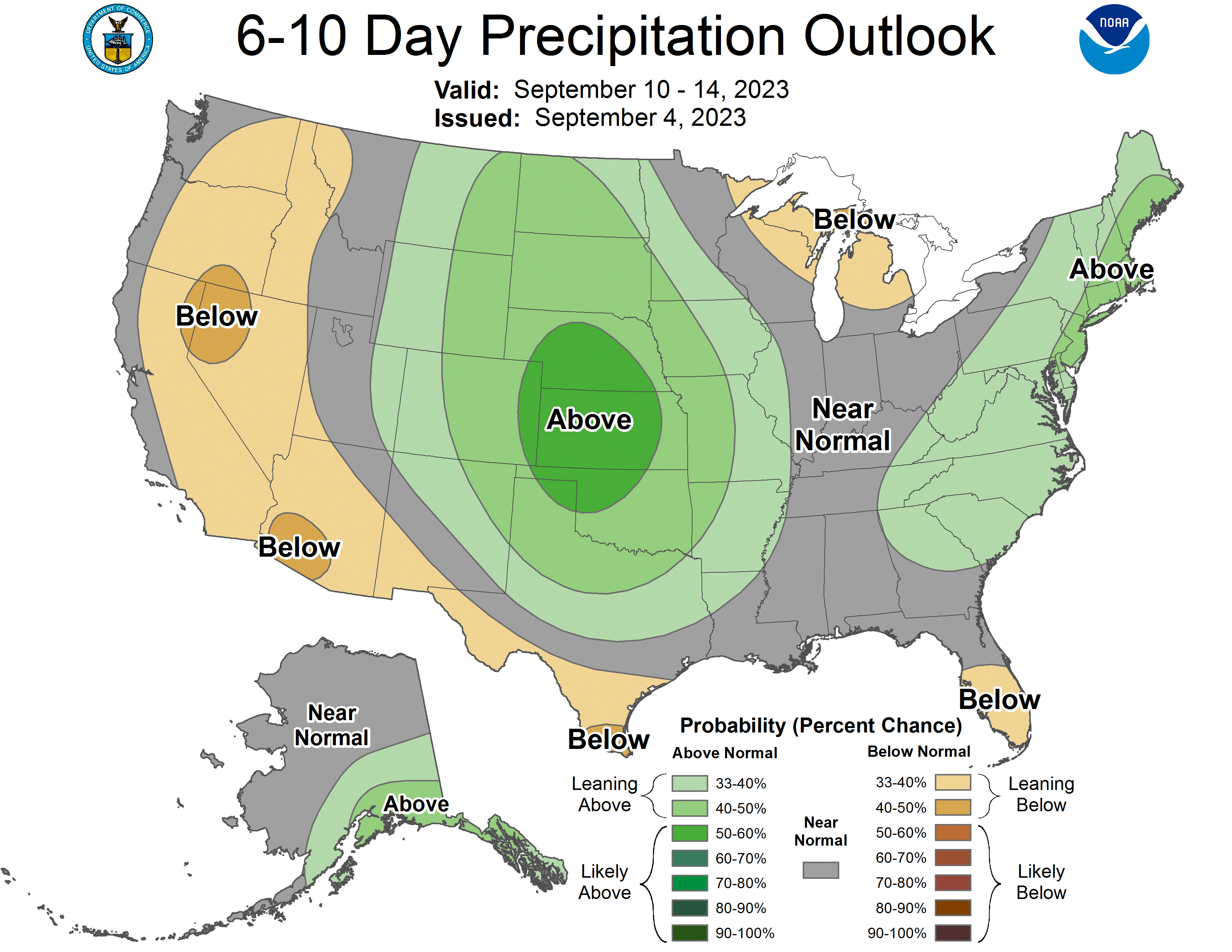
State Climatologist Justin Glisan says a dominant ridge of high pressure and major tropical storms on either coast has left Iowa dry at a time of high moisture demand from crops. Glisan says the current Climate Prediction Center outlooks give equal chances of above or below normal precipitation this fall, although a strong El Nino in the Pacific may drive wetter patterns into the region.
However, Glisan says for those areas in severe drought or worse — which includes Marion and Warren Counties, it will take several rounds of rainfall before significant drought relief will be felt in those communities.
A slight chance for storms exists late this evening as a cold front sweeps through, and much more comfortable conditions are in the forecast through this coming weekend, according to the National Weather Service. The outlook for next week from the Climate Prediction Center also shows above average chances for precipitation.