
While there is still a long ways to go to solving local drought, a much wetter than normal month of January has been a needed boost with springtime looming in south central Iowa.
Many area rain gauges have received approximately 1/2″ to 1″ of precipitation this week after multiple rounds of freezing rain, drizzle, fog, and rainfall. Lake Red Rock has recorded .9″ during that time. This came after most communities recorded between 16-24″ of snowfall between several storm systems starting January 8th.
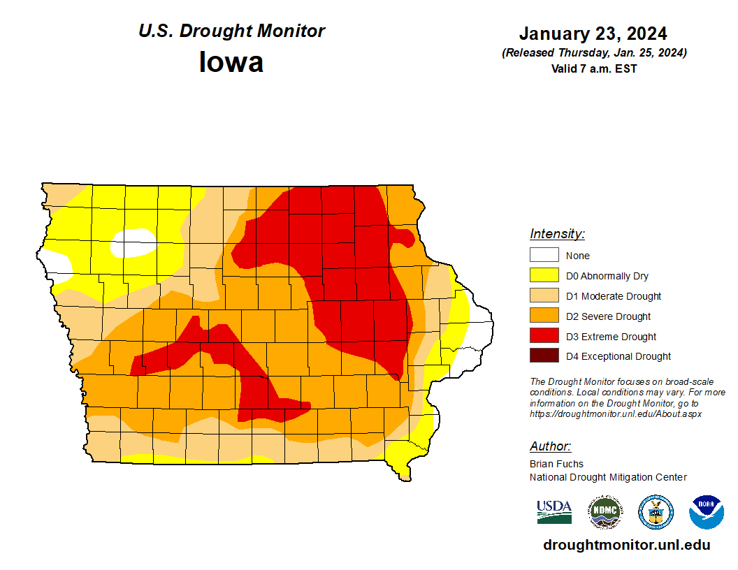
The most recent U.S. Drought Monitor report showed some relief from extreme conditions locally, with the update cutoff from this past Monday.
According to the National Weather Service, warmer than average temperatures will continue well into next week, with the sun finally making an appearance consistently starting Monday and highs in the upper 30s and even low 40s by Thursday. Snow melt could be a minor traffic concern in isolated locations as it refreezes overnight.