
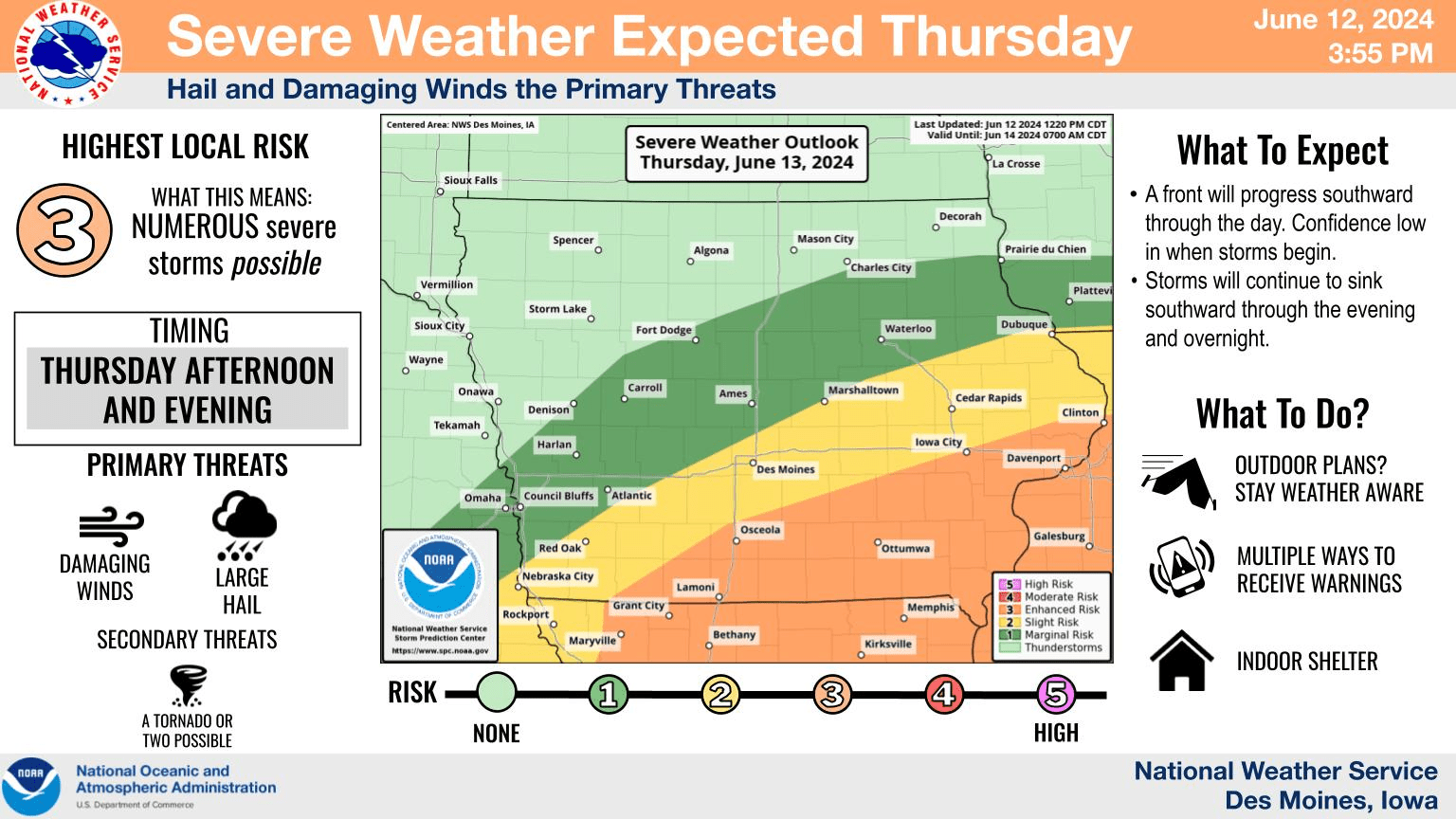
The risk for severe weather has increased across the region today. Most of south central Iowa is in the enhanced category, or 3 out of 5, from the National Weather Service Storm Prediction Center. A line of storms could bring winds in excess of 70 MPH and large hail, as well as brief, torrential downpours. The KNIA/KRLS Severe Weather Action Team is on the air for any severe thunderstorm or tornado warning for Marion and Warren Counties.