
There are several chances for snow this week, according to the National Weather Service.
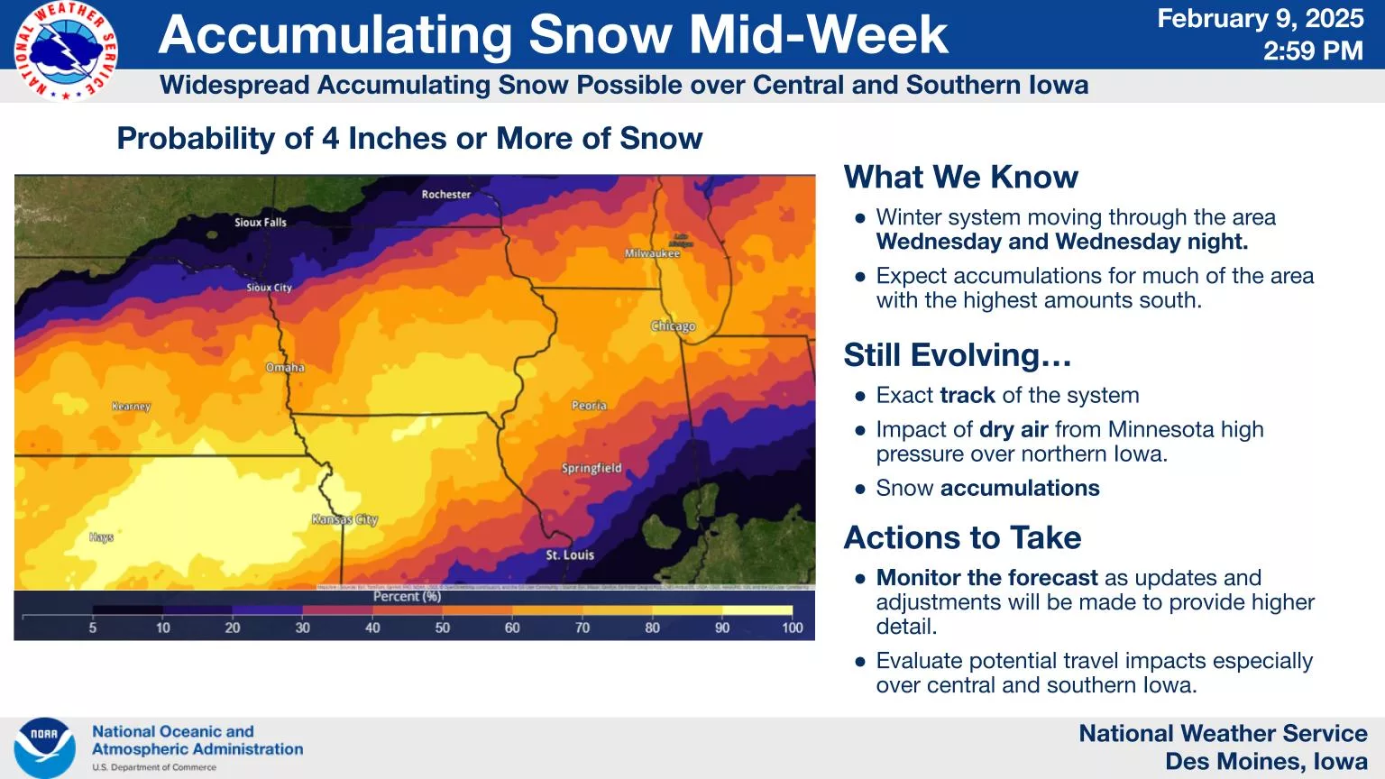
The first will come late this evening into early Tuesday, with snow totals ranging from a trace to possibly one inch. A more impactful winter storm is forecast to arrive Tuesday night through Wednesday, with the highest chance for accumulating snow over south central Iowa. At least three inches of snow is expected to fall over the course of the day Wednesday, although final totals will become more refined over the next 24 hours.
Finally, snow is also possible again late in the week into early this coming weekend, but the details are uncertain at this time. Continue to monitor the forecast for updates.
Temperatures will also be below normal this week with Tuesday and Thursday mornings featuring wind chills at around or below zero degrees locally.