
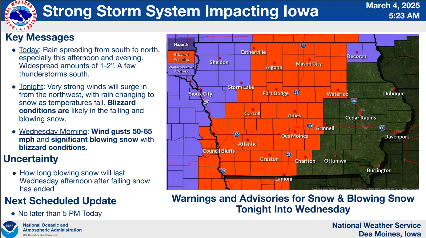
Powerful winds mixed with snow will likely cause major travel issues Wednesday, according to the National Weather Service. A Blizzard Warning has been issued for Marion, Warren, and Jasper Counties. Rounds of rainfall today will transition to snow by late tonight, with wind gusts up to 60 MPH coming with a cold front. As the wind speeds increase, rain will transition to snow. While accumulations will remain in flux, any snowfall will cause travel hazards due to the wind speeds, and wet pavement will likely freeze in the morning as well. Snow should taper off by late Wednesday morning, but gusty conditions will continue into the early evening.